Geography and History
Covering an area of 187,502 square kilometers Sistan and Baluchistan province is the second widest province of Iran after Khorasan. This province is composed of two regions of Sistan and Baluchistan. The townships of the province are Iranshahr, Chah-Bahar, Khash, Zabol, Zahedan, Saravan, and Neek-Shahr. Zahedan is the capital city of the province.
The population of the province in 1996 was 722,579 of which 46.12 % were registered as urban dwellers and 52.75% as rural dwellers and remaining were non-residents. From geological point of view, due to tectonic activities Sistan and Baluchistan province was separated from the sea in the late Cenozoic period and since then it is packed with the sea calcareous sediments as well as other relatively big and soft sediments. The southern part of of the province, which is called Mokran, is one of the regions which is gradually subsiding due to the high thickness of sandy sediments which is gradually subsiding due to the high thickness of sandy sediments which have been remained from Cenzoic period and is more than 1 kilometer. The heights of the province belong to Mesozoic and Cenozoic periods mostly composed of limestone and gypsum. Geologists believe that some mountains of the province (like Taftan volcano) belong to late Cenozoic and early Quaternary periods. Sistan and Baluchistan heights are a part of central mountains of Iran and include uneven lands of east of Chalehloot as well as the heights of eastern and southern walls of Jazmoorian low land.
Regarding geographical situation, Sistan and Baluchistan region is under the influence of several atmospheric currents from one hand and under the high pressure of middle latitudes on the other hand, of which the most important obvious climatic phenomenon is warmth. The considerable phenomena in the meteorological condition of this region are blow of seasonal strong winds, sand storms, heavy showers, high humidity, and morning fog. This province enjoys long and hot summers and short winters. The coldest city of the province is Zahedan and the warmest city is Iranshahr. The coastal areas of the Sea of Oman enjoy warm weather with relatively higher humidity due to closeness to sea. Sistan and Baluchistan is one of the driest provinces of the country. Annual precipitation increases westward and in the coastal zones average humidity is very high. Sistan and Baluchistan province is exposed to seasonal winds from different directions of which the most important are 120-day wind (Levar), Ghosse wind, Seventh (Gawkosh) wind, Nambi or South wind, Hooshak wind, seasonal and humid winds of the Indian Osean, North (Gurich) wind, and Western (Gard) wind.
From natural characteristics and past records of settlement point of view, Sistan and Baluchistan province is composed of two entirely different regions of Sistan and Baluchistan. Today Sistan is the northern part of the province. Historians attribute the foundation of Sistan to one of the offspring of Kiumars namely Gorshasb. This region has been very important due to its specific geographical and strategic position during all periods of history. According to the inscriptions of Bisotoon and Persepolis, Sistan has been one of the eastern provinces of Achaemenian. The name of Sistan is attributed to one of the Aryan tribes that conquered it in the year 128 BC.
In the reign of Ardeshir Babakan, Sistan was a part of Sassanide government and was conquered by Arabs in 23 AH. Finally in the time of Moavieh, the Omavi caliph, this region was completely subordinated by him. The first famous governor of this land was Yaghub Lays Saffari, the founder of Saffarian dynasty. The region remained under the domination of Saffarian governors for several centuries. The dynasties of Saffarian, Samanian, Ghaznavian, and Saljughian ruled over this land for some times. The region was badly damaged after the attack of Mongols.
Shah Ismail Safavid conquered Sistan in 914AH. In the reign of Nader Shah, local differences caused many damages in this region. The oldest name of Baluchistan is “Moka” which has been changed to Mokran along the time. Now, the southern part of Baluchistan is called Mokran. The name of Baluchistan has been attributed to this land since the settlement of Baluchi tribes in this region.
According to archeological excavations and obtained objects and vestiges, the history of this land dates back to 3,000 BC. Arabs conquered this land in the reign of the second caliph of Islam and one of the Arab commanders was assigned as its governor.
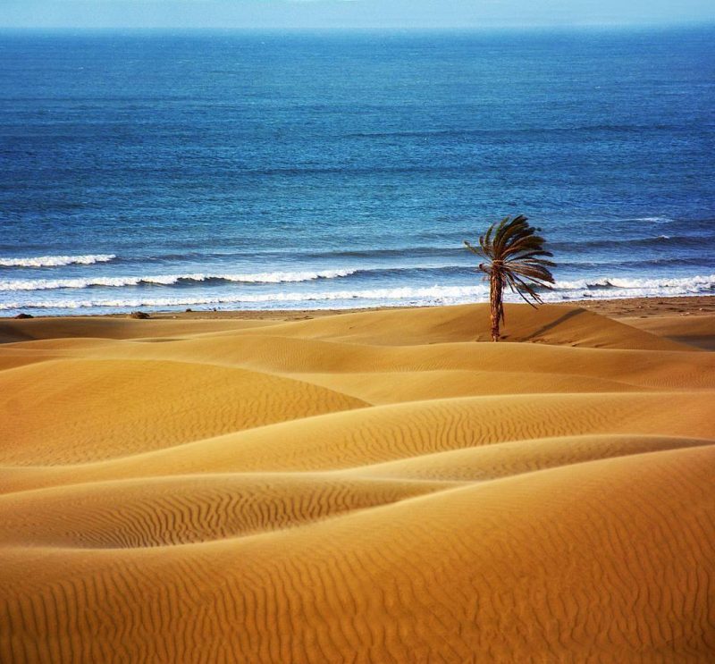
Daylamian conquered this land in the year 304 AH. After the conquest of Baluchistan by Saljughies, it became a part of Kerman province. After Nader Shah, it was a part of Iran without an independent local government. In the time of Mohammed Shah Ghajar, Iranshahr region was conquered and since then all coastal parts of Baluchistan gradually were subordinated by central government of Iran. From natural attractions point of view, Sistan and Baluchistan province is one of the worth-seeing places of Iran. The Sea of Oman and its coasts, wetlands, lakes, mineral water springs, promenades, heights, summits, caves, and… are among the attractions of this province. Sistan and Baluchistan province holds several historical and religious monuments that annually attract many tourists. Hereunder, the historical, cultural and tourism visage of the townships of the province are discussed.
Zahedan
Locating in a plain, Zahedan is the capital city of the province. Its climate in the southern part is warm and in the northern part is relatively mild.
In the year 1315 AH a Qanat (subterrancan canal) was digged by one of the inhabitants of the region and caused the appearance of small village that was named Dozdab. After the entering of Belgian experts for establishment of customs office, it gradually developed and attracted more population. In 1935 AD, it was renamed as Zahedan and expanded rapidly and became the center of the province. The important natural, historical and religious monuments of this province are:
- Eskal-Abad mineral water spring Zyarat-Goorband spring in the southwest of Zahedan,
- Loghmat-Kooh spring in the southwest of Zahedan,
- Yar-Mohammedi spring in the south of Zahedan,
- Keshman-Kalateh promenade in Zahedan
- Malieh-Goorband mall in Zahedan,
- Natural landscapes of Kalateh in the south of Zahedan Saam fort on Zahedan-Zabol road,
- Caravansary of Robat-Shoorgaz Anthropological Museum in Cultural Heritage Directorate, Zahedan,
- Zahedan Jame’ Mosque,
- Zahedan Shiite Jame’ Mosque,
- Imamzadeh Malek-Sial 46 km. north of Zahedan.
Zabol
Zabol Township is located 1,828 km. far from Tehran enjoying a warm climate.
Formerly, this township was called Sistan (Sagestan) and Neemrooz. In the year 1935 AD it was named Zabol according to the approval of cabinet and became the center of Sistan in 1936 AD. There is in the southern slopes of it the ruins of some monuments that is attributed to Parthian that has been very glorious in that time. The important natural, historical and religious sights of the township are:
- Shahreh-Sookhteh in 60 km. south of Zabol,
- The remains of old Zahedan city in Posh-Ab district of Zabol,
- Dahaneh-Gholaman hill , 44 km. far from Zabol,
- Tasooki hills,
- Korkoy fire-temple,
- Taymour castle in Post-Ab district,
- Zabol castle,
- Mian-Kongi castle in the north of Zabol,
- She-Kooheh castle in Shibab district,
- Ghasem-Abad high tower in Ghasem-Abad
- Hakim Mosque,
- Sharifi Mosque,
- The mausoleum of Khajeh Mehdi.
Iranshahr
Iranshahr Township is 1.987 km. far from Tehran enjoying a changeable climate depending on the altitude of different parts from the sea level, but totally it is hot. Iranshahr is one of the old cities of Iran that was formerly called “Fahraj”. The city has been a verdant and lively region late in Achaemenian time. In the reign of Nasereddin Shah Ghajar, the governor of Baluchistan constructed some castles in this region of healthy climate. Since then, it gradually developed as a city. The important worth-seeing places of the city are:
- Recreational areas of Sarbas river which is the habitat of Iranian crocodile,
- Bampour forest park and luxuriant slopes of it,
- Konti thermal spring in the west of Tong village,
- Hoodian thermal spring on the Bazman-Delghan road,
- Maksan thermal spring on the Bazman-Maksan road,
- Tasht thermal spring on the Bazman road,
- Jamshid thermal spring on the Bazman_kalateh road,
- Espidezh thermal spring on the Bazman road,
- Puzed-Dabbagh thermal spring 200 km. west of the city,
- Bazman thermal springs in Bazman village Katookan thermal spring in the north of Katoogan,
- Bazman Protected Area in Bazman,
- The old castle of Iranshahr,
- Espidezh castle,
- Doost Mohammed Khan castle,
- Peep castle 142 km. far from Iranshahr,
- Firooz-Abad castle, 190 km. south to Fahraj,
- Haridook castle, 130km. of Fahraj, Haridook village,
- Said-Abad castle, 34 km. far from Fahraj,
- Bazman castle on Iranshahr-Faraj-Bazman road
- The old castle of Daman, 36 km, northeaster to Fahraj,
- Maskootan old castle, 153 km. far from Fahraj,
- Chehel Dokhtar and Sarbaz castles.
Khash
Khash is one of the old cities of Sistan and Baluchistan Province that its foundation dates back to pre-Nader dates back to pre-Nader time. After The Killing of Nader Shah, British forces entered Khash and constructed some buildings there. It gradually developed as a cily in course of time. The important worth-sceing places of the city are:
- Mount Taftan,
- Mineral water Qanat of Kooklu on the Khash-Mirjaveh road,
- Mineral water spring of Dushing on Khash-Zahedan road,
- Eest of Taftan thermal spring in the west of Sangan village,
- Barabak thermal spring 14 km. far from Sangan village,
- Zang mineral water spring in the west of Sangan village,
- Morghab and Ganj-e-Amin mineral water spring in the west of Sangan village, ·
- Torshab mineral waters on Khash-Zahedan road,
- Taftan park.
Chabahar
Enjoying a warm climate, Chabahar Township is 2,382 km. far from Tehran. The southern part of it is humid due to closeness to the Sea of Oman. Formerly, being one of the trade centers of the Sea of Oman, it was named “Badaris” and was very thriving. At present, it is very important from strategic point of view and is one of the trade free zones of the country. The important natural, historical, and religious places of the city are:
- Bahoo-Kalat Protected Area,
- The coasts of Chabaliar and installations of Shahid Beheshti
- Teess cave,
- The old castle of Teess 9 km. north to Chabalar,
- The old tree of licus banglensis,
- Siahboon hill,
- The old castle of Ghasr-e-Ghand 34 km. far from the city,
- Imamızadeh Gholam-Rassooli,
- The mausoleum of Sheik Shamil 162 km. far from Chabahar.
Leave a Reply